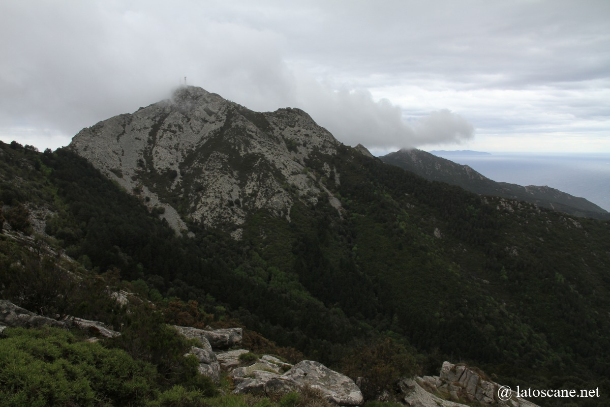
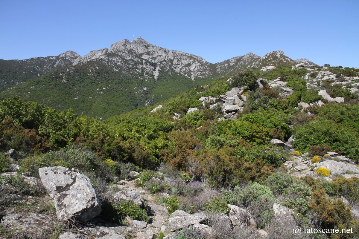
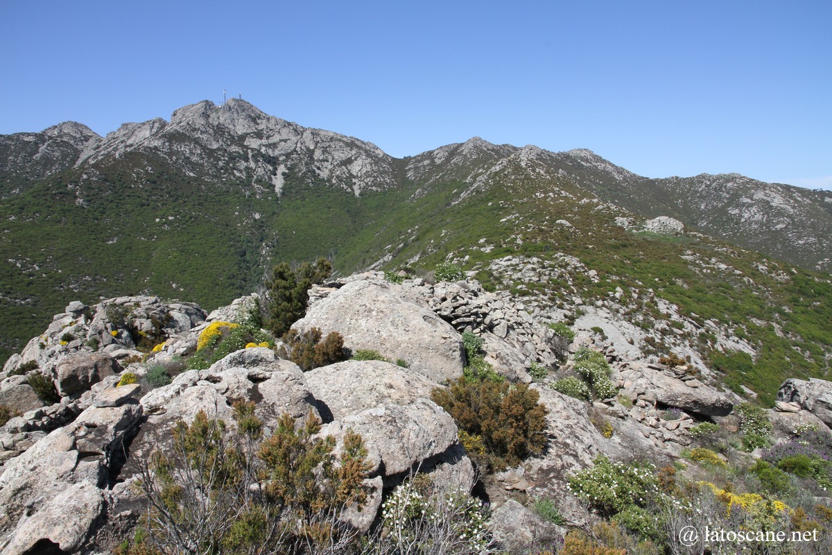
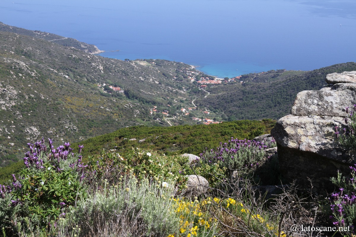
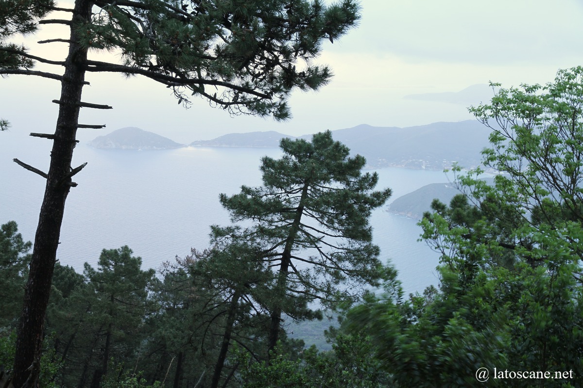
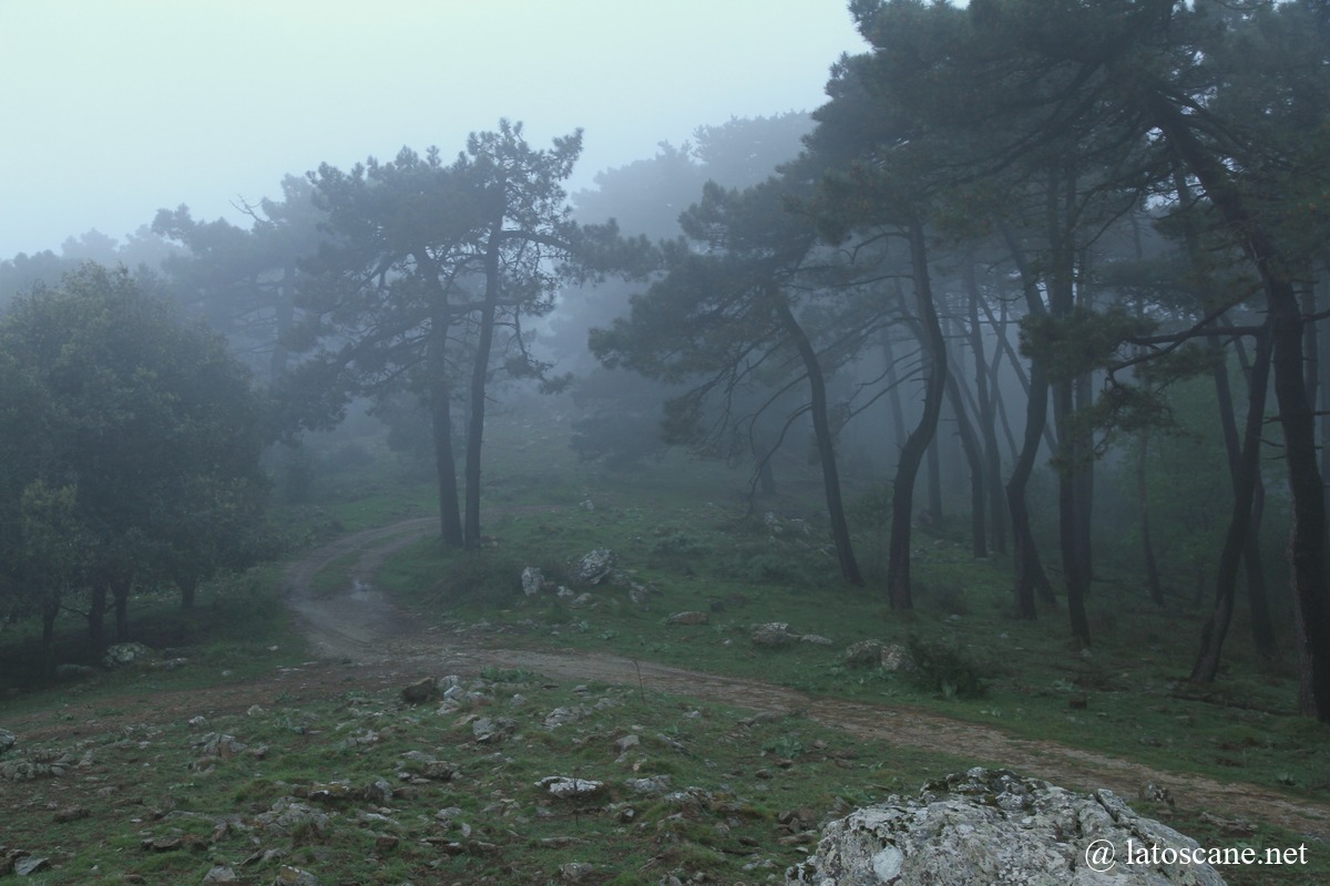
Mount Capanne, reaching 1,019 meters, is the highest point on Elba Island and dominates the landscape of the Tuscan Archipelago. Its slopes present a striking contrast with the coastline: chestnut forests, Mediterranean scrub, and granite rocks alternate up to the summit, where the panoramic view encompasses the entire island and the Tyrrhenian Sea. The mountain is crossed by a network of hiking trails of varying difficulty, suitable for families as well as experienced hikers, and dotted with remarkable natural sites and historical remains. The villages and hamlets at its foothills, such as Marciana and Poggio, retain a rural charm with their narrow streets, ancient churches, and agricultural terraces.
How to reach the summit
- By cable car: departing from the village of Marciana, approximately 18-minute ride in small open cabins offering continuous panoramic views. Service runs from spring to autumn.
- On foot: several marked trails lead to the summit:
- Marciana Trail (2 to 3 hours walk, through forests and scrub).
- Poggio Trail, connecting to the main route.
- Ridge Path from Mount Perone.
- Etc
Main attractions and points of interest
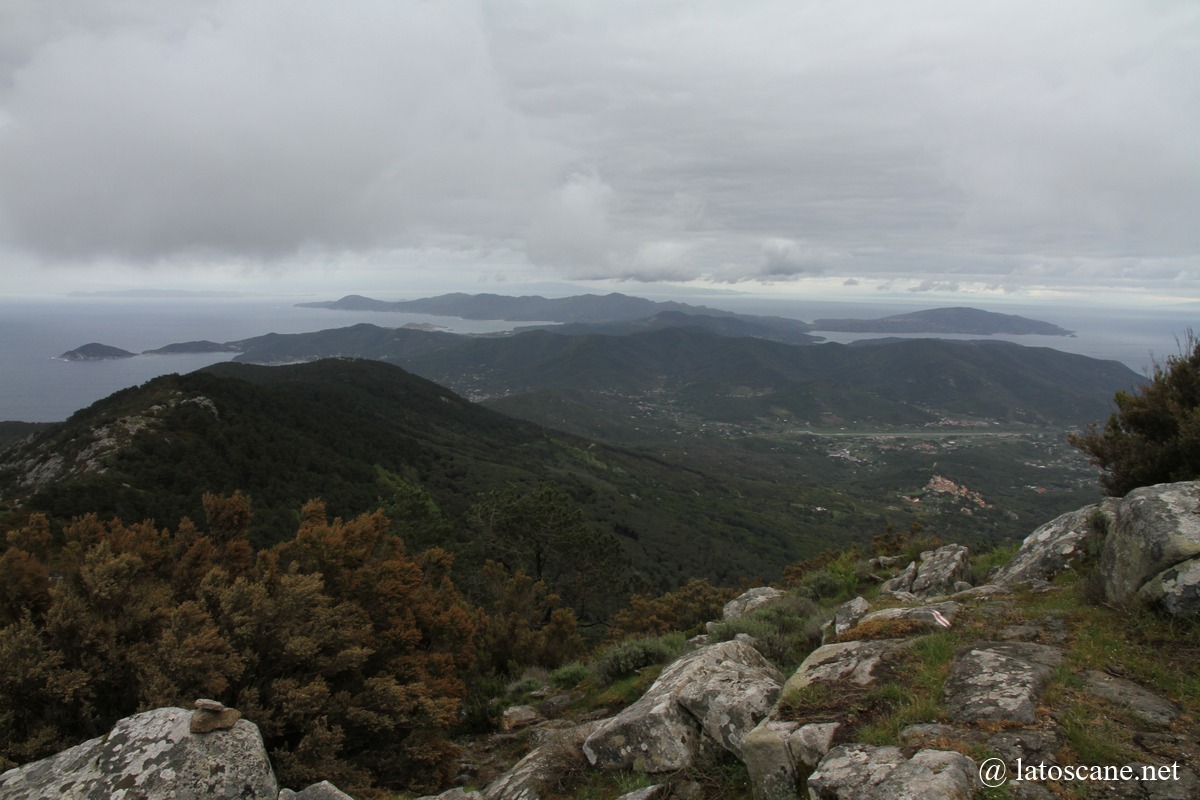
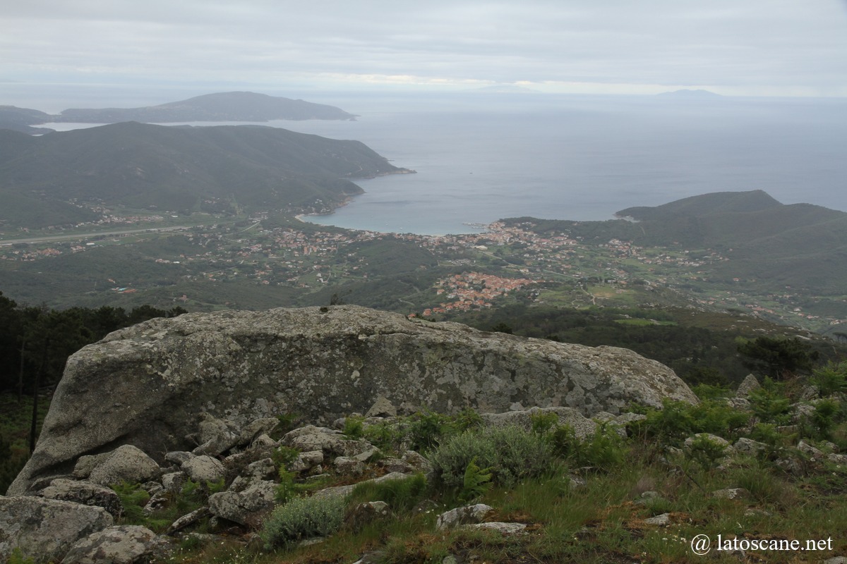
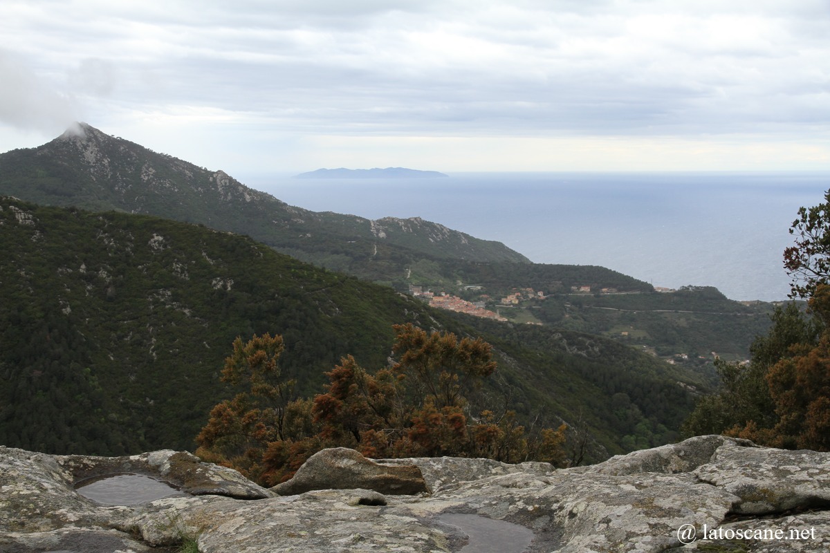
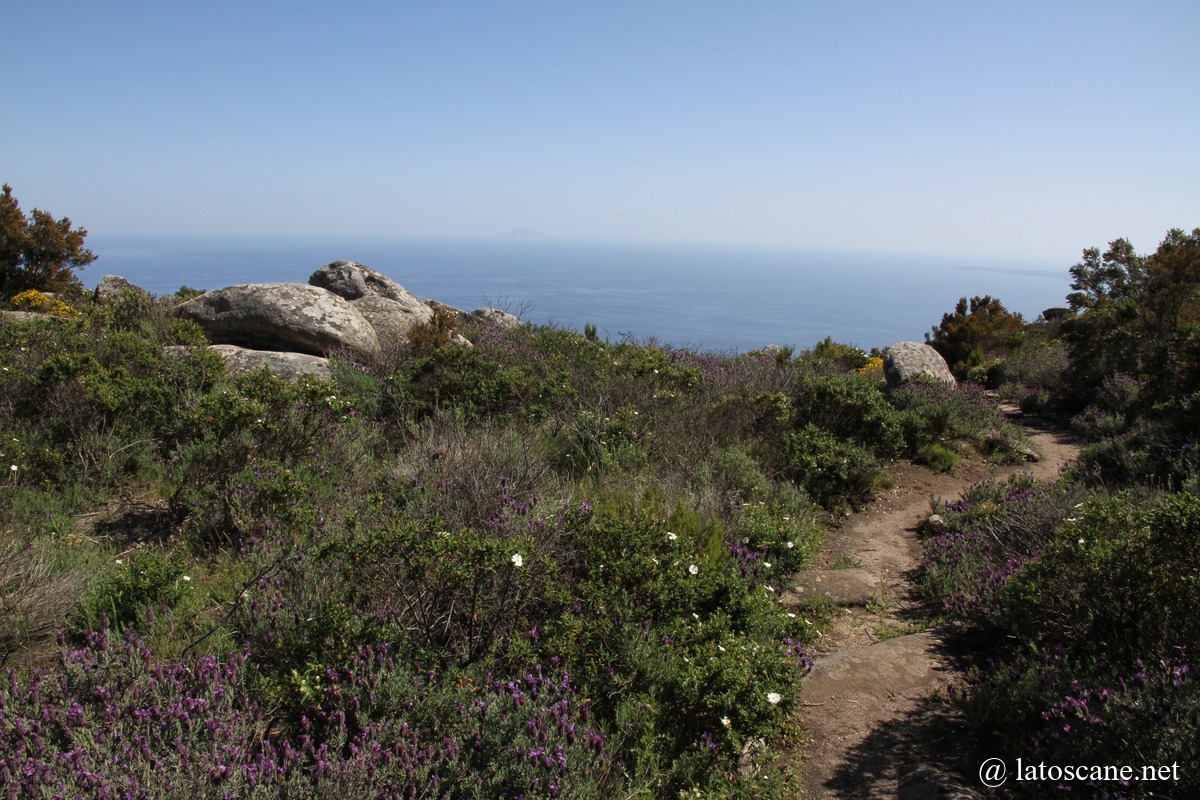
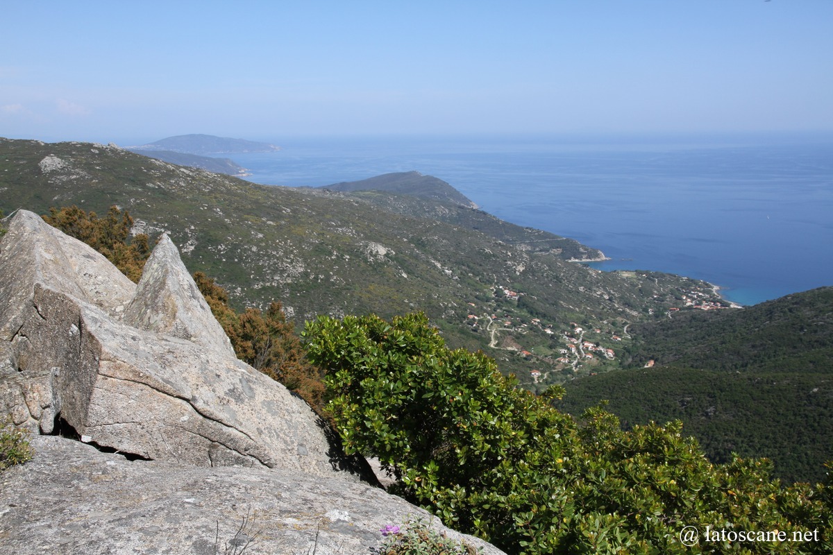
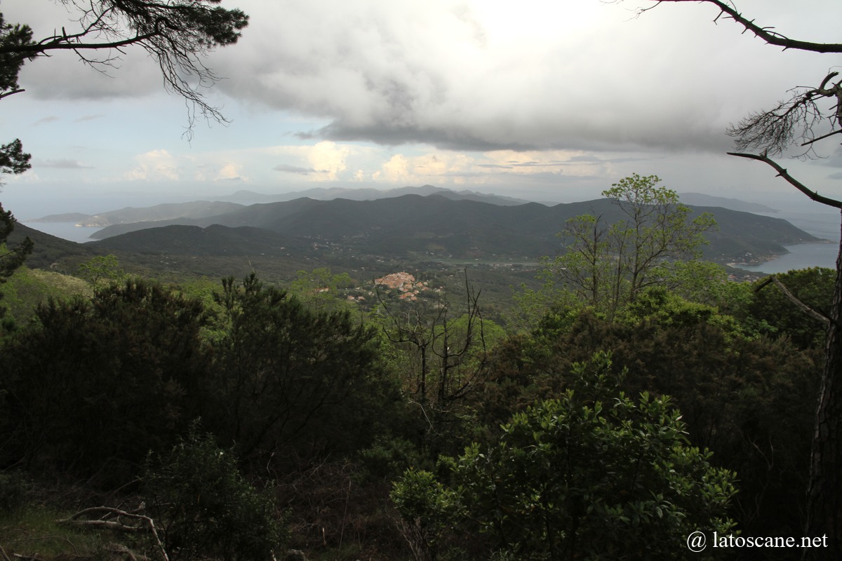
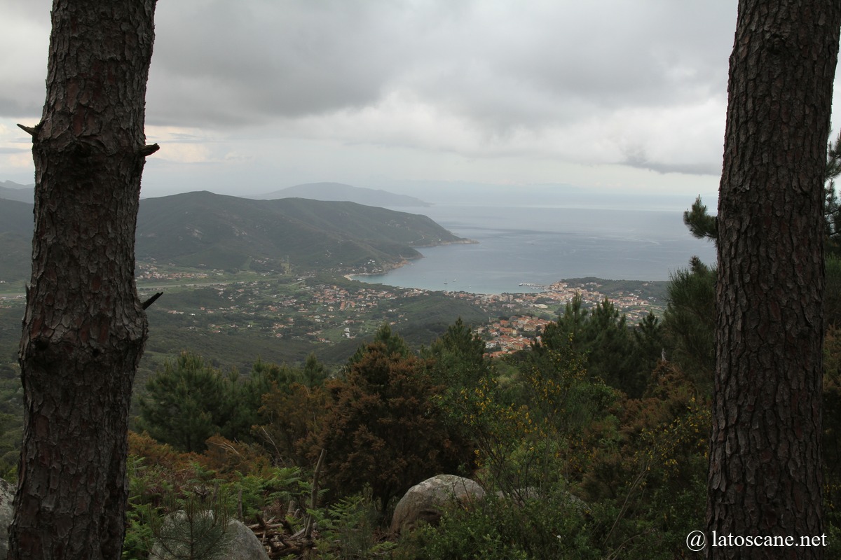
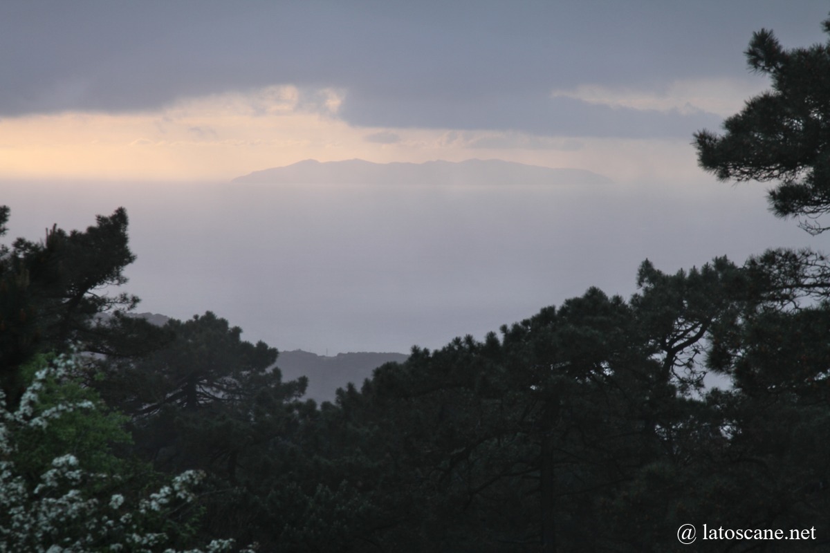
- Summit of Mount Capanne: 360° panorama over the island and the sea, accessible by hiking or cable car from Marciana. At the summit (1,019 m), clear views cover the entire island, the other islands of the Tuscan Archipelago, and on clear days, as far as Corsica.
- Ridge Trail (Sentiero delle Creste) GTE: scenic route linking several secondary peaks and offering spectacular views of the western coast.
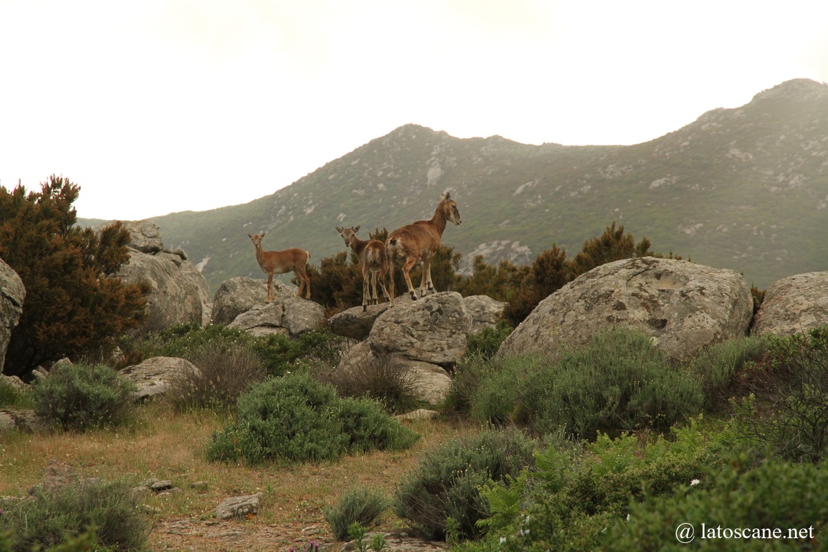
- Flora and fauna: strawberry trees, chestnut trees, Mediterranean scrub, holm oaks, myrtle, mouflons, wild boars, and birds of prey.
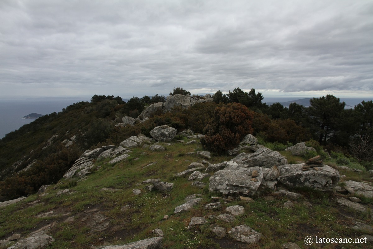
- Granite landscape: rock formations shaped by wind, monumental boulders and cliffs.
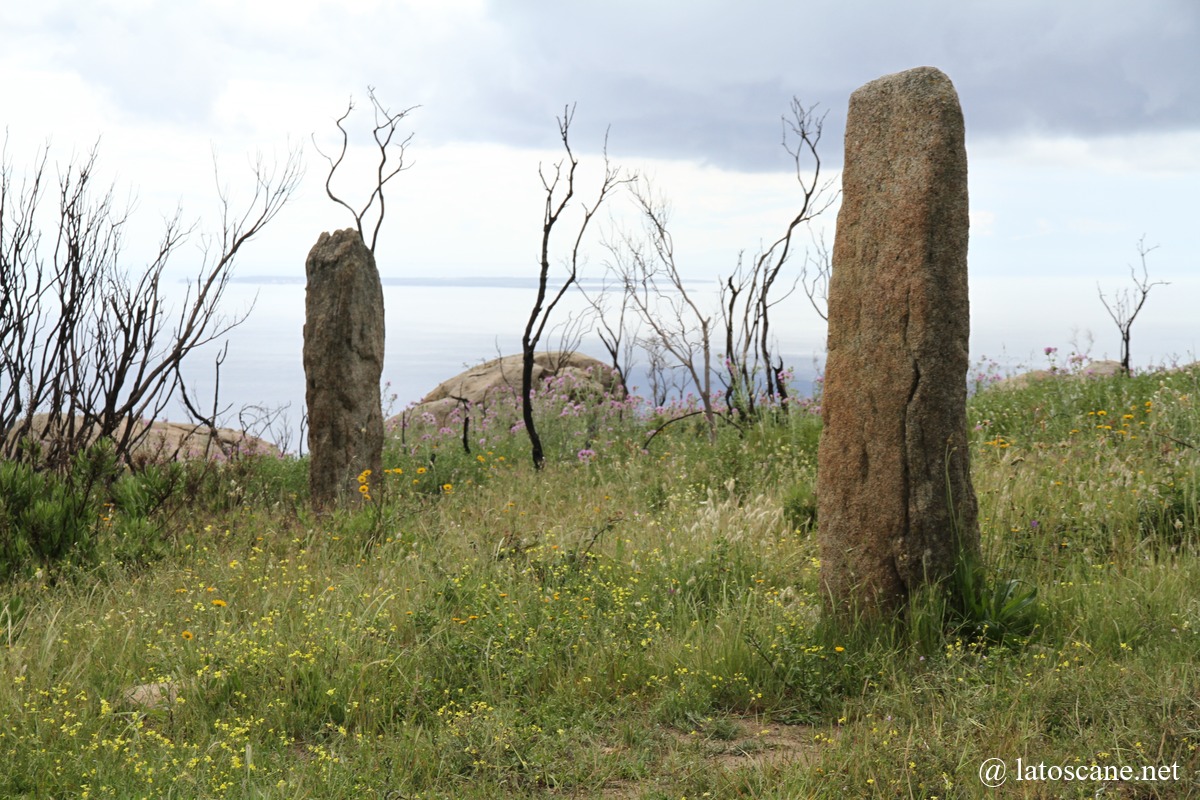
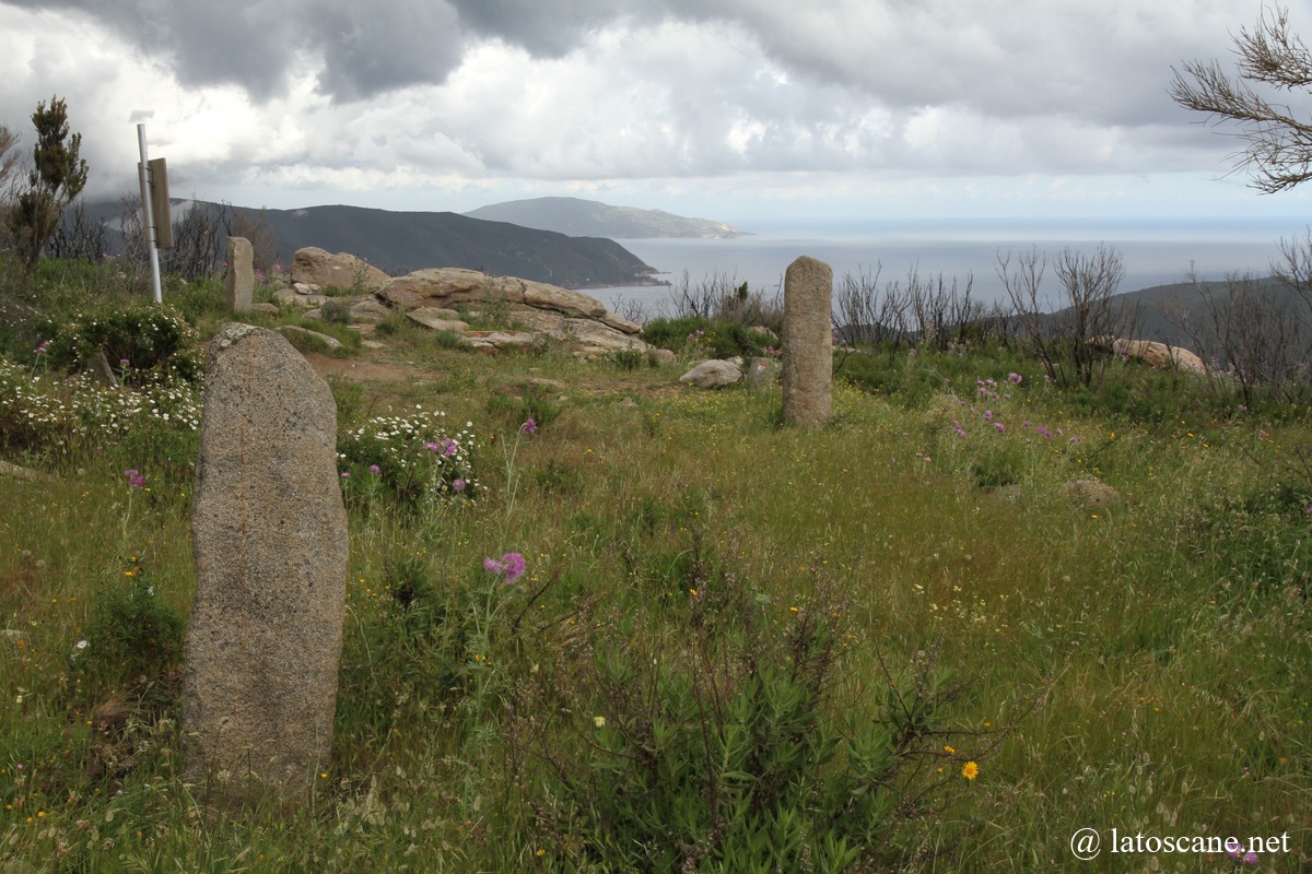
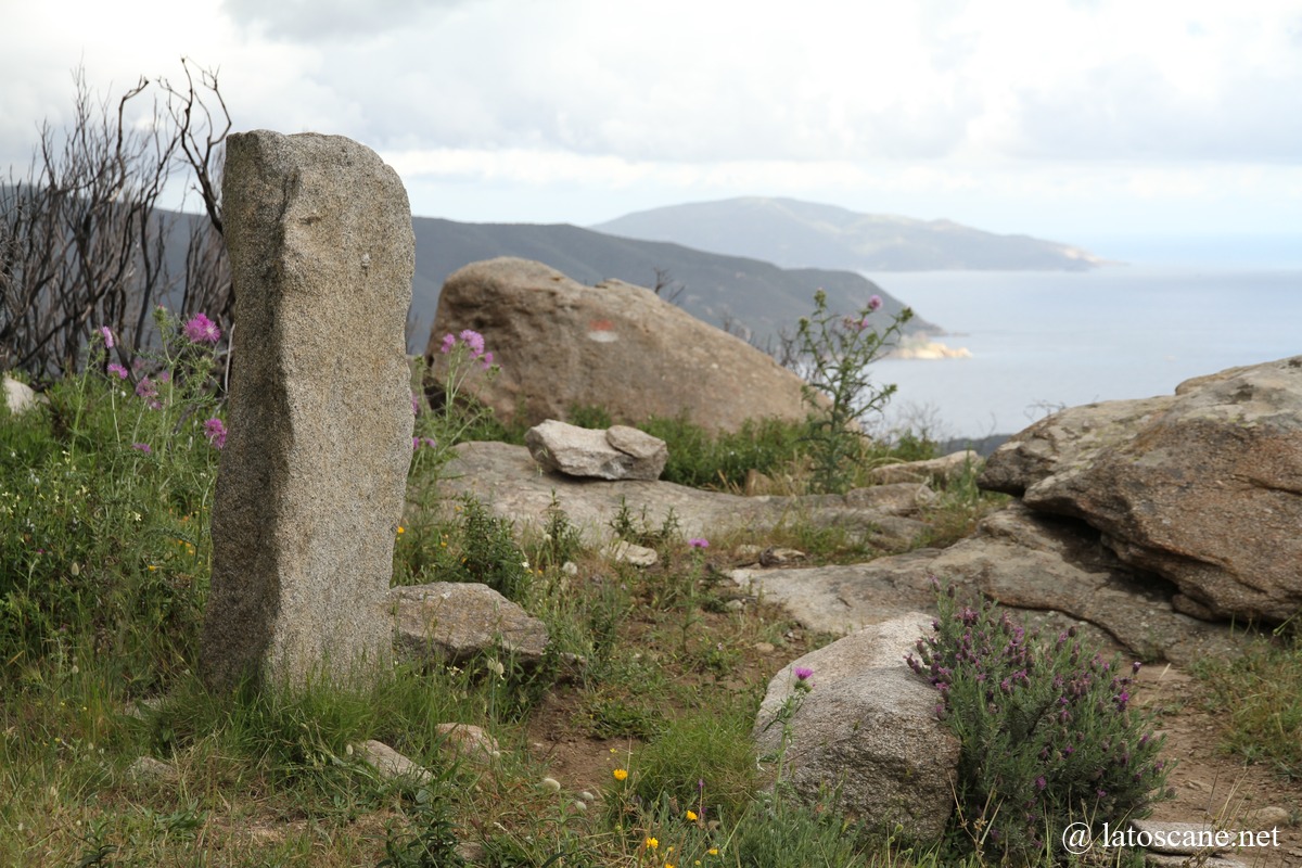
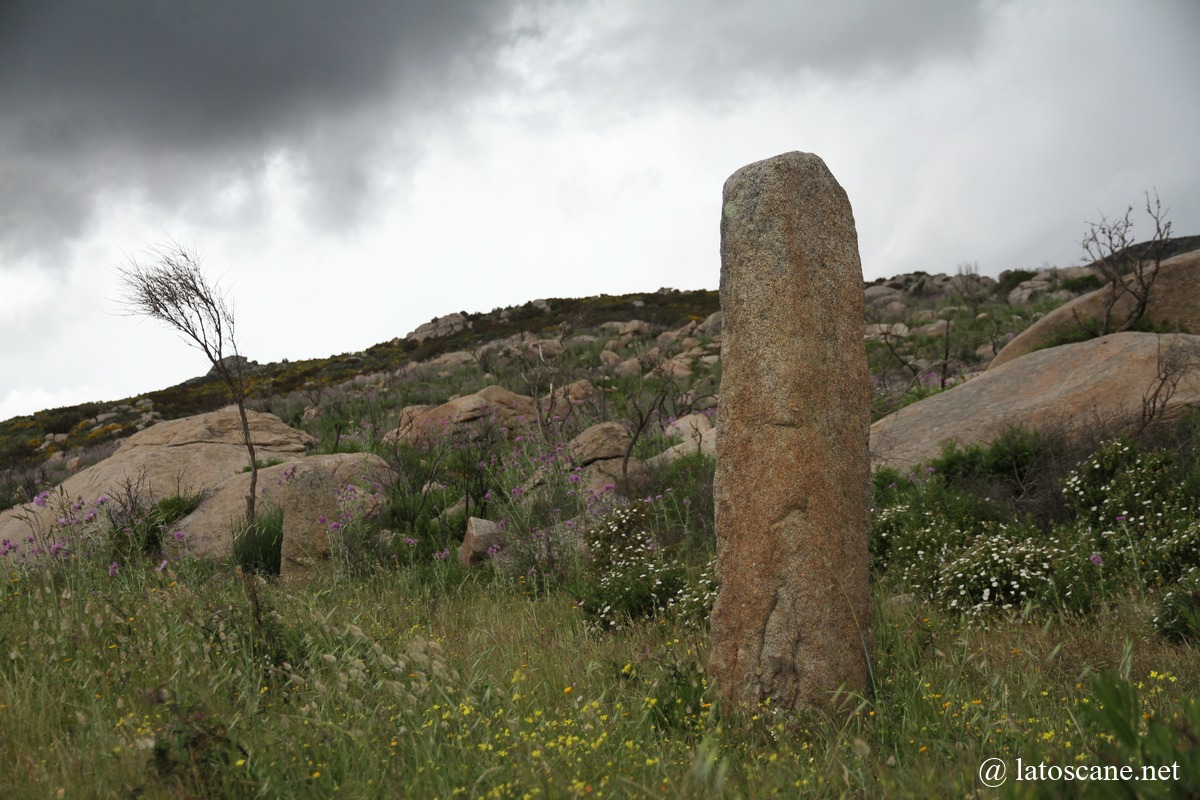
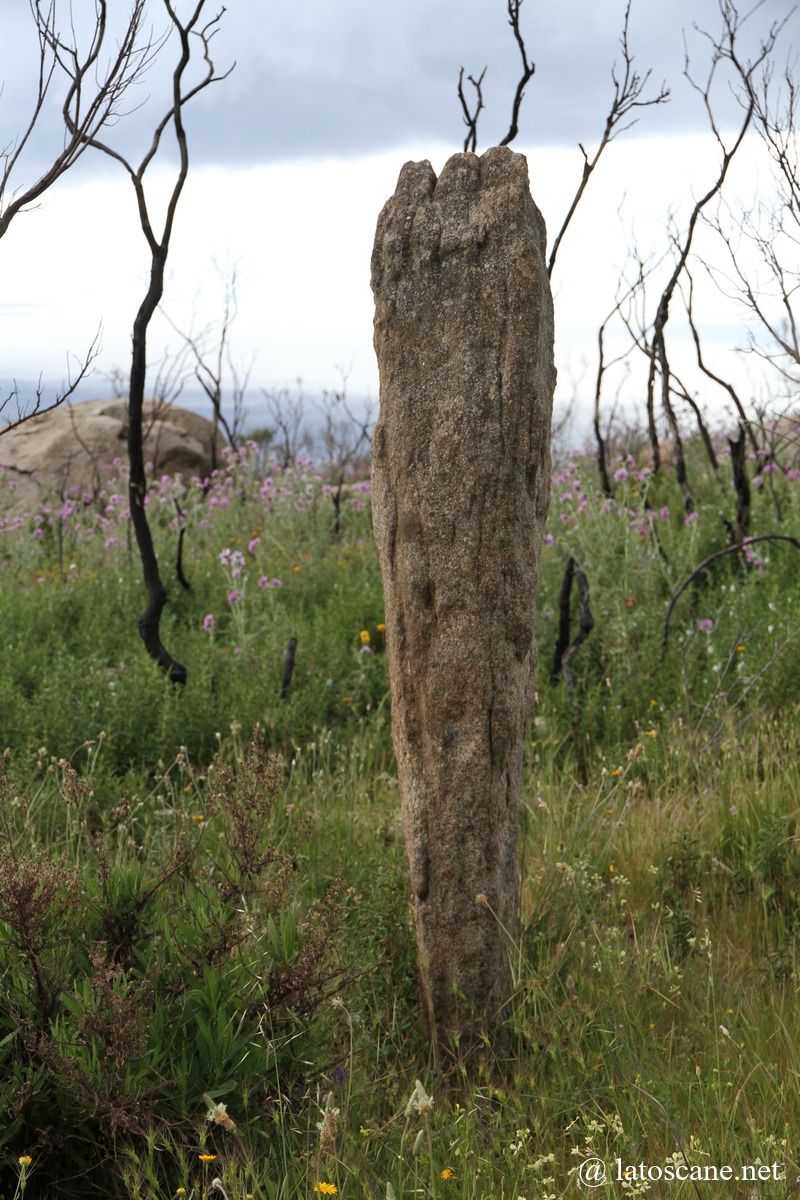
- Remarkable prehistoric sites: standing stones and megaliths, particularly at Sassi Ritti.
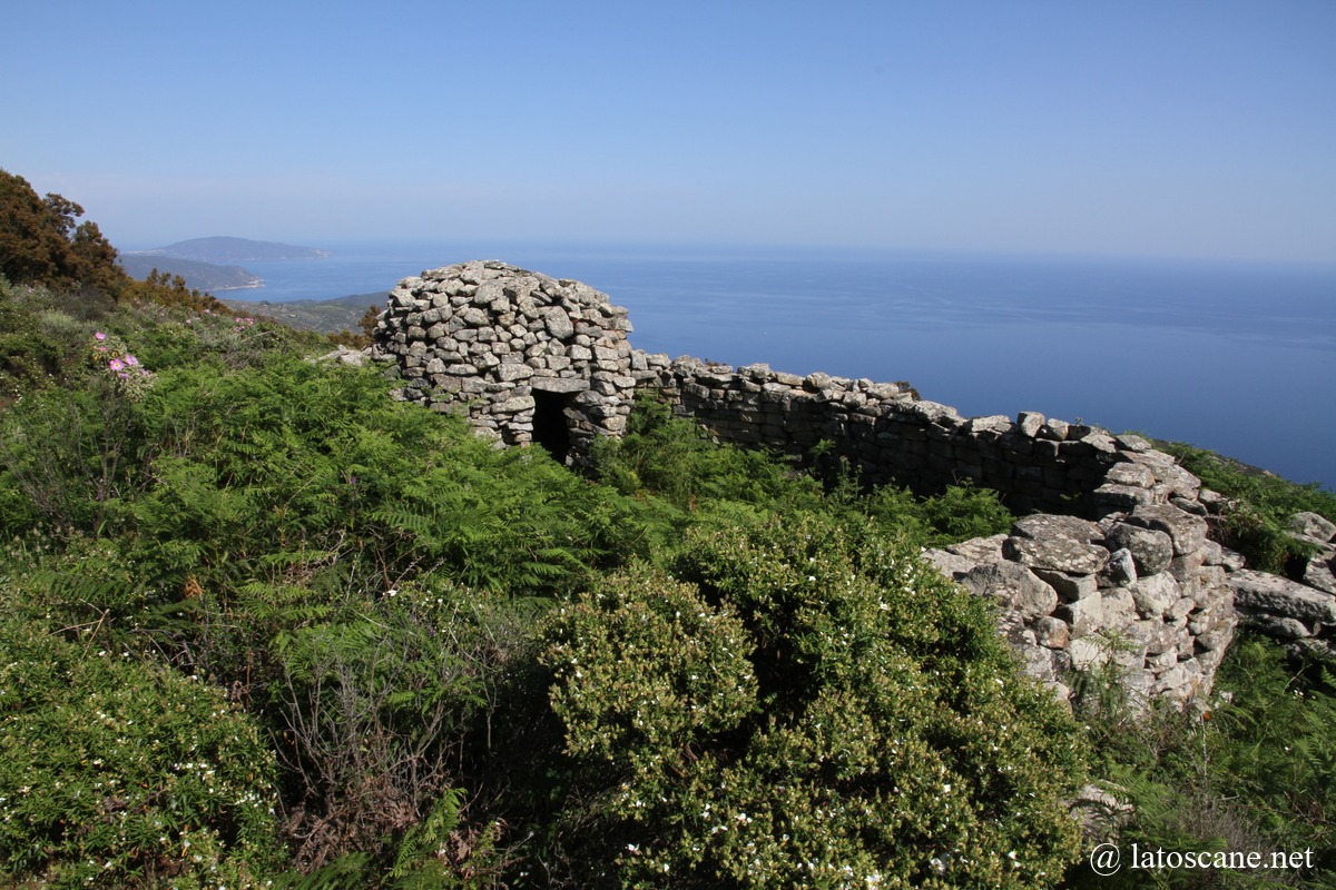
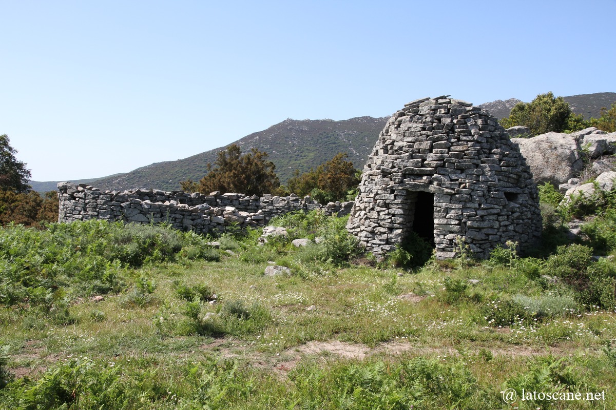
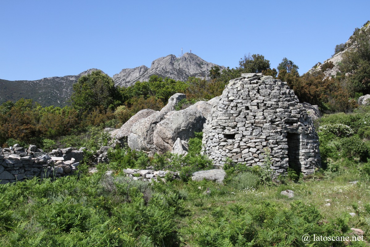
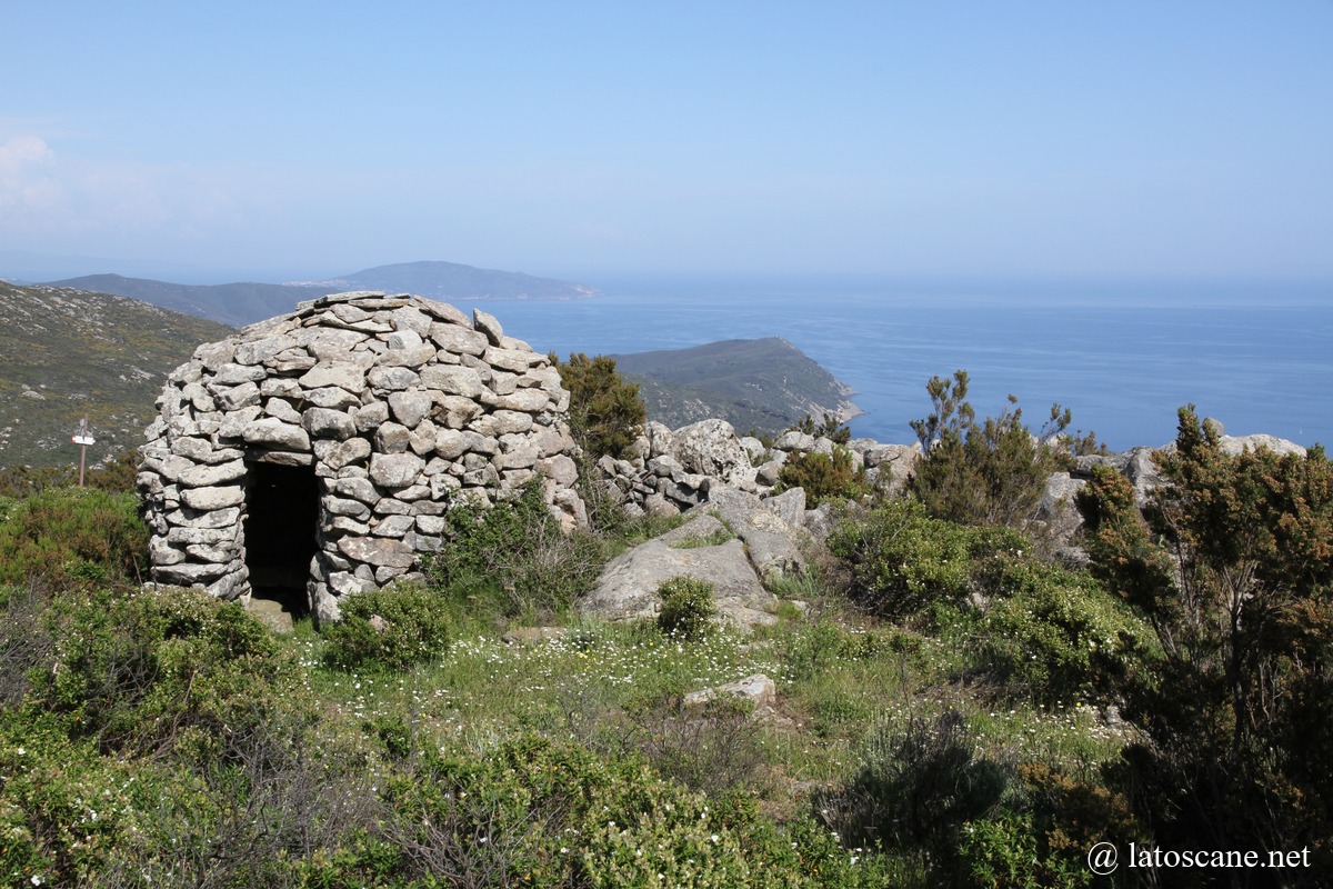
- Ancient agricultural terraces, millstones, ruins of fortifications or rural buildings such as caprile, dry-stone sheepfolds.
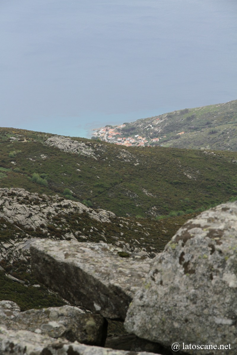
- Trails to the coast: routes descending to Cavoli, Fetovaia, and Pomonte, allowing a combination of mountain and beach.
Various Trails and Sites of Mount Capanne
Via Ferrata – Technical Ascent
Starting point: Monte Capanne
Difficulty: Very High (EEA)
Description: This technical ascent allows reaching the Capanne summit from the nearby pass. It includes sections equipped with cables and metal rungs.
Grande Traversata Elbana (GTE): East-West Section via Monte Perone (Summary)
The GTE is the island’s long-distance traverse (≈ 50–60 km depending on variants) connecting the eastern coast (Cavo/Porto Azzurro) to the western coast (Pomonte/Patresi). The East-West variant passing through Monte Perone (≈630 m) ascends from the eastern part of the island, climbs Perone via forest roads and trails (intersecting routes no. 117, 122, 169, 121…), then follows the island ridge toward Monte Capanne.
The Monte Perone → Monte Capanne section is among the most scenic: ridges, dry stone walls, caprili (pastoral enclosures), landmarks such as Colle della Grottaccia, Le Mure, Monte Cenno, Monte Orlano in sequence, before descending to the western coast (Pomonte or Patresi depending on the branch).
For the entire GTE: distance ≈ 53 km, cumulative positive elevation ≈ ~2,200–2,300 m, total duration 3–4 days depending on pace; the section around Perone represents an ascent of about 1,700 m in segments with a local elevation gain of roughly +~400 m for the climb to Perone from the approaches. The GTE is marked, but includes technical sections.
From/To Marciana
Marciana → Monte Capanne: Trail 101
Starting point: Marciana, near Sant’Agabito Gate / Arrival: Monte Capanne summit.
High difficulty (EE) / 3.6 km / Elevation gain: 601 m / Estimated time: 2h45
Description: This trail ascends the northern slopes of the massif, offering panoramic views of the northern coast of the island and of Marciana.
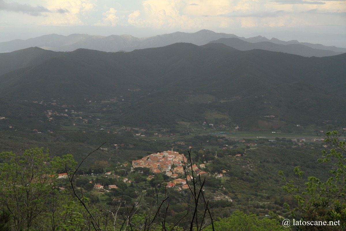
Points of interest: Romitorio di San Cerbone: 6th-century hermitage, built in 575 AD, dedicated to Saint Cerbonius, located about 2.3 km from the start. Panoramic view from the summit of Monte Capanne.
Marciana → Chiessi (or Pomonte) – Crossing Monte Capanne: Trail 103 (or 104)
Starting point: Marciana / Ending point: Chiessi
Difficulty: Moderate (E) / Distance: 10.8 km / Elevation gain: 383 m, loss: 754 m / Estimated time: About 4h40
Description: This trail connects the northern and southern slopes of Monte Capanne.
Points of interest: Sanctuary of Madonna del Monte, Colle di San Bartolomeo: Waypoint offering views over the valley and the sea. Pianoro dell’Oppito: Plateau with interesting rock formations and typical Mediterranean flora. Ancient agricultural terraces: Remains of the historical agrosilvopastoral activity on the island.
A fork allows descent to Pomonte via Trail 104.
Marciana → Patresi: Trail 113 / GTE or 103 / GTE
Marciana → Zanca: Trail 113
Marciana Marina → Marciana: Trail 157
From Poggio
Poggio → Monte Capanne, via Caprile del Malpasso: Trail 106
Departure: Poggio / Arrival: Monte Capanne
Difficulty: High (EEA) / 6.3 km / Elevation gain: About 650 m / Estimated time: 4h
Description: Starts from the village of Poggio and ascends via Malpasso, a rocky pass, and the Caprile del Malpasso, an ancient pastoral area. The trail offers spectacular panoramas of Elba Island and the sea, passes through characteristic rock formations, and zones of Mediterranean vegetation.
Points of interest: Caprile del Malpasso: Former pastoral enclosure, providing insight into the island’s agro-pastoral history. Malpasso: Mountain pass located between Monte Capanne and the Filicaie, with open views over the valley. Via Ferrata: Route equipped with cables and metal rungs, allowing a secure ascent of Monte Capanne.
Poggio → Pomonte, Grande Traversata Elbana (GTE) South
Route: The GTE South crosses the southwestern ridge of Elba Island, passing Monte Capanne without reaching its summit. Estimated duration: About 6 to 7 hours for the section between Poggio and Pomonte.
The GTE is rated Difficult, with technical sections and significant elevation changes.
Fork: Near Monte Capanne, the GTE splits into two branches: GTE South: Leads to Pomonte, GTE North: Leads to Patresi.
Summit access: To reach the summit of Monte Capanne from the GTE, it is necessary to take Trail 101 or the via ferrata of Trail 100.
Points of interest: Filicaie, Monte Cenno, Le Mure, etc.
Chiessi ↔ Pomonte: Trails 103/104/126
Distance: 5 km / Elevation gain: 400 m / Difficulty: Medium (E) / Estimated time: ~2h30
This trail connects Chiessi to Pomonte, ascending via Trail 103 and descending via Trail 104, offering views of the sea and passing through Mediterranean forests. It is often combined with Trail 126 to form a loop.
Chiessi ↔ Troppolo (Trail 103 and Trail 125)
From Chiessi to Trail 103 at Il Troppolo, a junction point of the Elba Grand Traverse (GTE). Estimated duration: approximately 1h30.
This trail provides an immersion in Mediterranean nature, with panoramic sea views and unique geological formations. It ascends in a zigzag on the steep slope, offering spectacular views of the sea, with thermometamorphic rocks formed around 7 million years ago by the cooling of Monte Capanne’s magma.
From/To San Piero in Campo
San Piero in Campo → Monte Capanne via Pietra Murata: Trail 105
Start: San Piero in Campo / End: Monte Capanne
Difficulty: Moderate (E) / Distance: Approximately 8 km / Elevation gain: Approximately 600 m / Estimated time: 3h30
Points of interest: Pietra Murata: Granite monolithic massif located at 600 m above sea level, offering a panoramic view of the Mediterranean Sea. This site is also a passage for capriles, the ancient pastoral enclosures.
Masso alla Quata: Imposing rock formation, characteristic of the island’s mountainous landscape.
Filicaie: Black pine forest, providing contrast with the surrounding Mediterranean vegetation.
San Piero → Sassi Ritti, megalithic complex: Trail 135B
Start: San Piero in Campo / End: Sassi Ritti
Difficulty: Moderate (E) / Distance: About 2 km / Elevation gain: 100 m / Estimated time: 1h
Points of interest: The Sassi Ritti are a megalithic complex consisting of four aniconic menhirs aligned north-south, probably related to a sun cult.
Lo Spino: Villanovan necropolis nearby, with circular tombs and upright boundary stones.
Macinelle: Old stone sheepfolds, providing insight into the island’s historical pastoral activity.
San Piero in Campo → Moncione: Trail 130
Start: San Piero in Campo / End: Moncione
Difficulty: Moderate (E) / Distance: About 5 km / Elevation gain: About 200 m / Estimated time: 2h
Points of interest: Moncione: Site with a stone hut built in the 1930s and a water mill dating from the late 19th century.
Macinelle: Old stone sheepfolds, offering insight into the island’s historical pastoral activity.
Pietra Murata: Granite rock formation with archaeological remains, including walls and graffiti.
San Piero in Campo → Monte Perone (GTE junction): Trail 107
Start: San Piero in Campo (near the sports field) / End: Junction with the GTE towards Monte Maolo / Monte Perone (~700 m) / Distance: 6.4 km / Time: approx. 3h10 / Elevation: +584 m / -177 m / Difficulty: medium
Notable points: granite quarrying remains, ruins of the church of Santa Maria delle Piane al Canale, reforested pine groves. Views: excellent panoramas from Masso alla Quata (707 m), large granite rock serving as a landmark and observation post.
Notes: sustained climb, shaded passages through pine woods, possible return via trails 124 or 119.
San Piero in Campo → Fetovaia: Trail 135
Starting point: San Piero in Campo (290 m above sea level) / End point: Fetovaia (on the coast)
Distance: About 9 km one way / Elevation gain: About 400 meters (650 with a variant) / Total descent: approx. 800 meters / Estimated duration: 3h50 for the ascent / Difficulty: medium.
Interest: The trail crosses the Vie del Granito, a historical network of paths used for granite extraction, initially winding in switchbacks. It passes near the Mulino del Moncione, an old water mill. After ~1.5 km you reach the Mulino del Moncione; the climb continues with dry stone walls, sheepfolds, and major granite slabs (Masso alla Quata/Pietra Murata depending on the variant).
The route offers panoramic views of the island’s west coast and Fetovaia Bay.
Notable sites: Piane alla Sughera, megalithic necropolis with circular tombs surrounded by vertical stones, dating to the Arzachena-Ozieri culture. The Sassi Ritti, megalithic ensemble of four aniconic menhirs, likely linked to a sun cult. Lo Spino: Villanovan necropolis nearby, with circular tombs and vertical stones.
San Piero → GTE (Monte Perone), via Trail No. 124 (107/124/119)
Trail No. 124 is a short connection between No. 107 (near San Piero) and No. 119 (near Monte Perone), about 3 km. From San Piero, first ascend on No. 107 for 1.5 km to the fork, then 124 continues with a gentler slope: it first crosses a pine forest, then enters a chestnut grove, passing low ridges and flowering woods. 300 to 500 meters of elevation gain.
From San Piero to Monte Perone via 124: approx. 5.5 km.
Trail No. 117 – Partial loop and access to Monte Perone
Trail No. 117 is a loop / short connection in the Monte Perone area (northeast/central sector of the island). Distance: a few kilometers, undulating profile, altitude between ~250 and ~350 m depending on variants, used by both hikers and mountain bikers.
On the ground it often serves as a link between local paths and sections of the GTE and offers several panoramic viewpoints over the north coast and central part of the island; it passes through oak groves and typical granite formations.
Sant’Ilario in Campo → GTE (Monte Perone): Trail No. 119
No. 119 is mainly a dirt road for fire service access, connecting Sant’Ilario to the GTE at Monte Perone. It is passable, relatively direct, and steep in some sections. Distance 4.2 km, elevation gain 400 m.
The path crosses maquis and pine landscapes, starting at the Sant’Ilario sports field.
Map of the Western Coast
If you see this after your page is loaded completely, leafletJS files are missing.
Suggested Visits and Hikes
Links and Information
- Monte Capanne Chairlift – Island of Elba (InfoElba)
Comprehensive guide to the Monte Capanne cable car: location, schedule, ticket prices, and panoramic views. - Monte Capanne: Hiking Guide to Elba’s Highest Peak
Overview of hiking trails leading to Monte Capanne summit, including difficulty levels and estimated durations. - Marciana → Monte Capanne Hike (AllTrails)
Detailed trail information: distance, elevation gain, and user reviews. - The “Granite Ways” – Routes and Megalithic Sites (Tuscan Archipelago Museums)
Cultural and archaeological context: circuits linked to granite, menhirs, and prehistoric sites such as Sassi Ritti. - Sassi Ritti and Megaliths of Elba Island (VirtualElba)
Description of the Sassi Ritti megalithic site: aniconic menhirs and their historical significance.
No Comments Yet